Text to Image
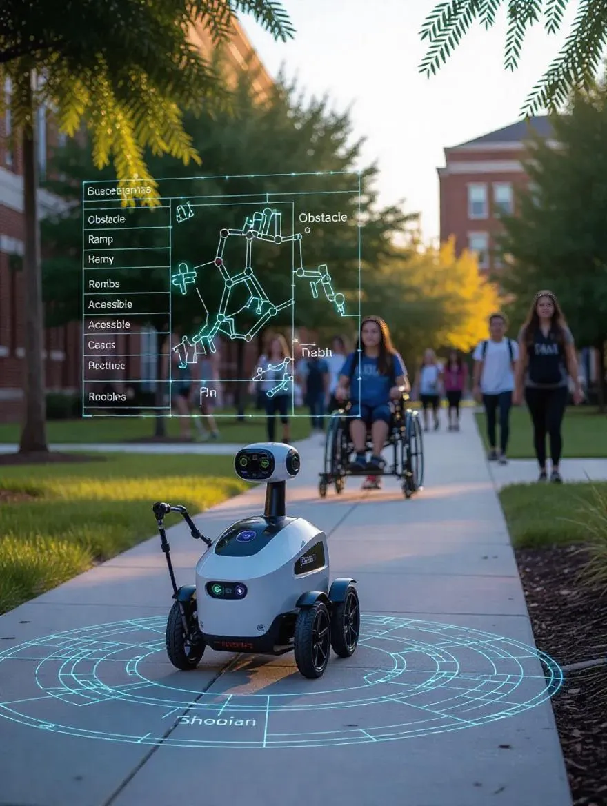
A small, sleek robot moves along a college campus pathway, equipped with visible sensors and cameras scanning the environment — detecting cracks in sidewalks, steep curbs, and uneven surfaces. The data collected is visualized as a glowing, holographic map above or around the robot, with labels like “Obstacle,” “Ramp,” and “Accessible Route.” Important: the robot is not guiding people, but gathering detailed terrain data to help urban planners and accessibility advocates improve campus infrastructure. In the background, students with mobility aids (wheelchairs, canes) navigate the campus, symbolizing the community that will benefit from this data. The campus setting includes trees, walkways, and academic buildings. Style is semi-realistic with a slight tech-futuristic edge. Use a cool color palette with high-contrast data overlays (neon green, soft red, blue). Mood: forward-thinking, inclusive, and solution-driven.